iCADdocs_online
iCAD Update Notes (February 2025)
Hello, and welcome again,
We are excited to bring more functions and features to our users. This release includes major and minor enhancements to the iCAD product suite - mainly Data Processing tools, Diversion Weir Design and TeraForm modules.
Learn about the update features and functions included in this release below.
Table of Contents
Update to Current Release
The current release of iCAD Software is Version 2.9.0.10683.
The acompanying iCAD Bridge application version is Version 4.9.5
IMPORTANT: Make sure AutoCAD is closed when updating. If not, the update process will fail to install the latest resources. We encourage you to review below links for guidance on how to install updates.
Follow below steps to update your installation to the latest release:
-
Download the Latest update Resource for iCAD Software
-
Follow the update instructions Installing Update Resources here to update your application.
NB: If you encounter issues on licensing and installation, You can find guidelines following the steps in the Introduction to iCAD Software document, chapter on Setup And Licensing Guide
What’s New
For this update the following major functionalities and capabilities are included, along with some bug fixes.
General
-
Session defintion process is enhanced with a feature to apply host sketches on the fly.
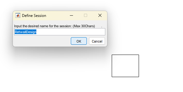
The sketch and user defined tag are applied upon setting the Object Types for the session.
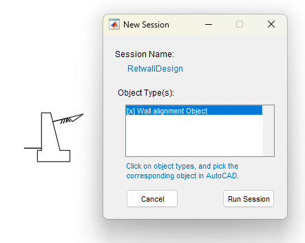
Note: Surface data host sketches are automatically applied upon hosting valid data to objects.
This reduces modelling time, and improves efficiency.
Terraform
-
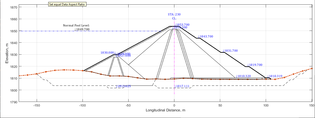
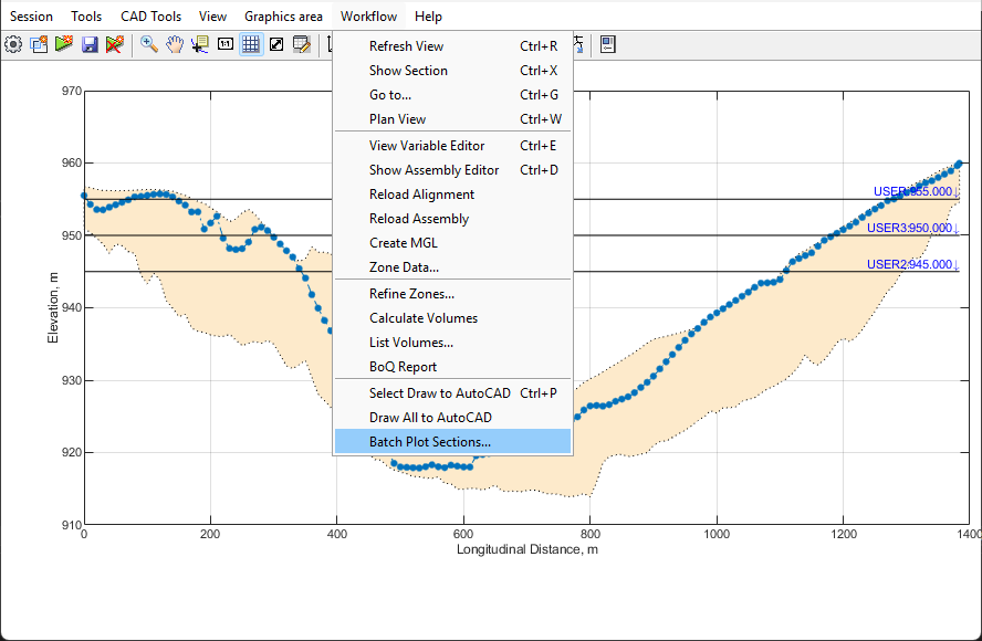
Design level values are displayed on Elevation view.
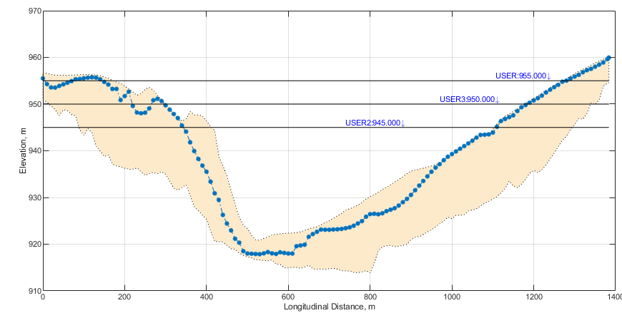
Similarly, on a cross-seciton view, elevation values are displayed.
-
Teraform is enhanced to allow generation of multiple cross-sections to AutoCAD at once.
-
In addition to enhanced color management tool (started in previous update), save as feature is included and enhanced.
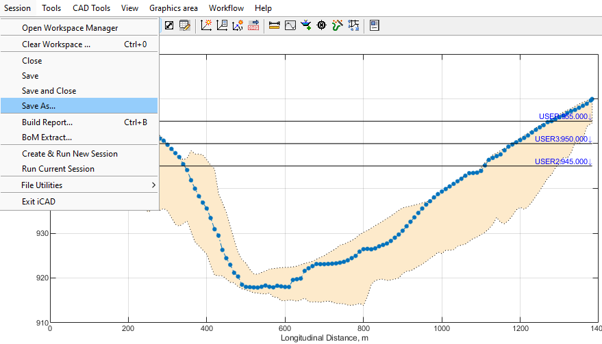
This allows working on, and comparing, different models of the same design problem. Giving users maximum flexibility.
ChannelRate
-
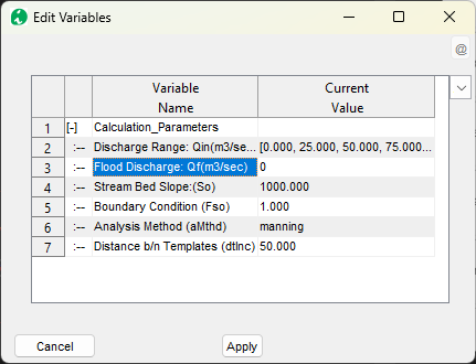
Allow release flood mark levels (variable editor now accepts 0 value)
-
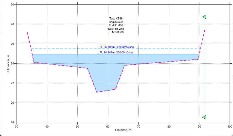
Show water levels in multiple sections, if available. This updae shows water surface levels in sections other than the base cross-section, if the multiSection method is used to solve for the rating curve.
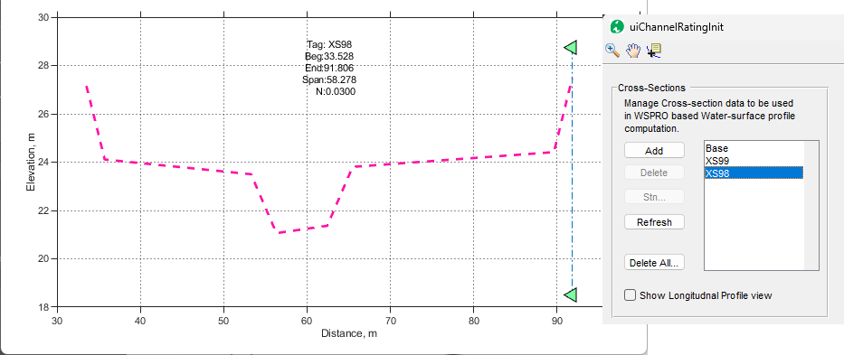
Figure: showing a cross-section downstream, but solved with Manning’s method.
-
Enhanced visual to identify if current displayed cross-section is the base cross-section or not. Those other than base cross-section are now drawn in broken lines. The water surface level and shades are also lightened a bit for better visualization.
Bug Fixes
- Data and AutoCAD object selection handling refined.
END.